Login   |   Contact Us Book a Demo

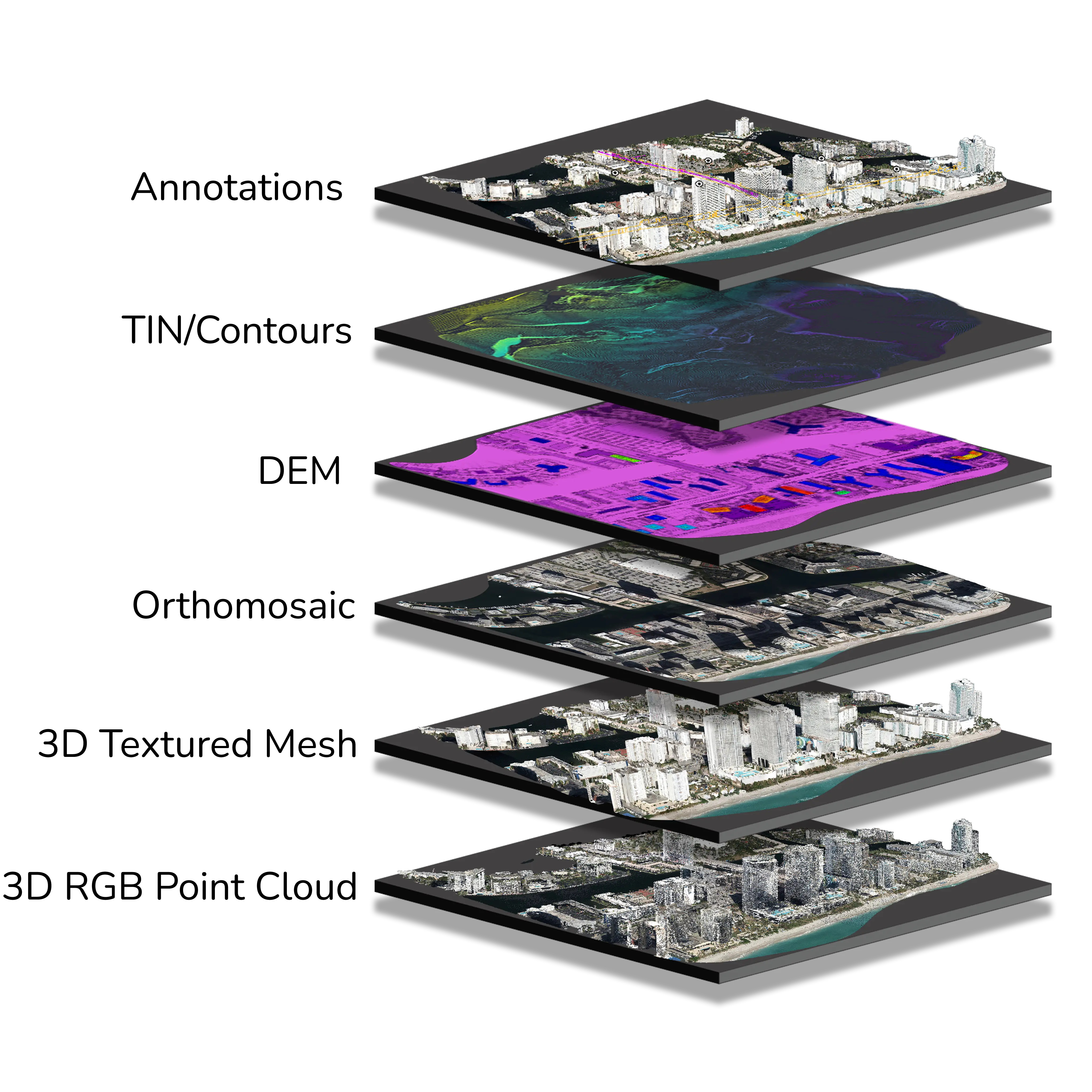
Your Complete Workflow, Delivered

From Raw Data to Engineering-Ready Outputs:
Turn drone and aerial imagery into accurate maps, models, and professional deliverables with PixElement's unified processing ecosystem.
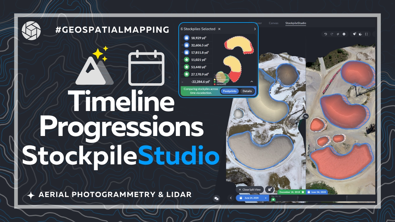
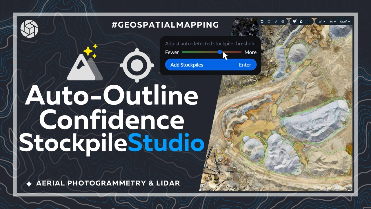
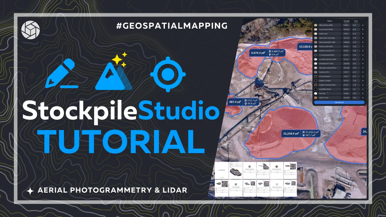
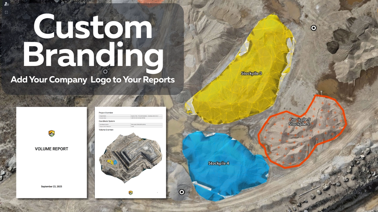
EXPLORE DELIVERABLES
01
MAP Precision Data Capture
02
EXTRACT Canvas Drafting & Analysis
03
DELIVER Engineering-Ready Insights
High-Altitude Airborne Drone Imagery Processing

Process Airborne Imagery

Process large-format aerial imagery and high-altitude datasets alongside your drone data.

LEARN MORE
Process Airborne Imagery
Work in the Canvas
Generate CAD + Reports
Process LiDAR & Imagery
Generate Contours & Elevation Data
FastDraft - Linework Services
Precise RTK Positioning
Annotate + Collaborate
StockpileStudio
Assign GCPs + Tiepoints
Compare Multiple Datasets
Perform Volume Calculations
Measure Areas & Distances
Validate Alignment & QC
Draft/Edit Linework

Who Uses PixElement?

Voices of PixElement

Rick Duthler - PixElement User Testimonial
Rick Duthler
Duthler Land Surveying
“PixElement is an easy-to-use, reliable image processing service that reliably provides data products that meet my specific accuracy needs.”
Andrew Zaydak - PixElement User Testimonial
Andrew Zaydak
Yotta Navigation
“PixElement has found a modernized approach to image processing with a focus on user-experience while still providing high accuracy results.”
Omar Mora - PixElement User Testimonial
Dr. Omar Mora
Westland Group INC
“Using PixElement’s cloud-based image processing software, I’m able to process huge datasets with a few clicks of a button. This frees up my desktop and alleviates any need for storage infrastructure. I love it!”

Industries We Serve

Construction Projects

Monitor site progress, verify drainage, and compare as-built data against engineering plans with millimeter precision.

Mining & Quarry Operations

Automate stockpile volumes, track material movement, and ensure environmental compliance across complex sites.

Infrastructure & Utilities

Inspect critical assets, model power line sag, and detect structural changes with high-resolution aerial mapping.

Environmental Assessment

Analyze terrain changes, map ecological impact, and generate precise elevation models for environmental monitoring.

Military & Intelligence

Rapidly process reconnaissance imagery for target identification, asset preparation, and mission-critical intelligence.