Every day, aerial systems around the world gather vast amounts of data. At PixElement, we’re dedicated to elevating the field of drone mapping to new heights.

Meet the Team

Our team is composed of dedicated professionals who are passionate about pushing the boundaries of what is possible in the field of photogrammetry, LiDAR, and geospatial as a whole. Get to know the faces behind the software and discover the expertise and creativity that fuels our mission to make aerial mapping even better.
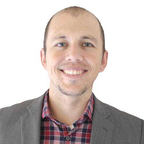
Benjamin Vander Jagt
Co-Founder / President of PixElement
The Ohio State University / Purdue University / Ferris State University
Zach Peugh
Zach Peugh
Chief Technology Officer / Lead Developer
The Ohio State University
I have a passion for problem solving, and love nothing more than a challenge. As the main software architect here at PixElement I have no shortage of challenges to overcome. I look forward to each day working towards creating the best photogrammetry and geospatial software in our class, with a fraction of the manpower as competitors. I’m proud to work with the incredibly talented engineers we have and it’s quite rewarding to see the team as a whole grow our collective skillset as the app matures.

Zoltan Koppanyi
Zoltan Koppanyi
Geodetic Engineer
Budapest University / The Ohio State University
I’m happy to get my hands dirty with almost anything in our stack. One day I am fixing a bug related to an "ok" button in a popup menu and another day I am trying to extract information from images using cutting-edge segmentation algorithms.

Siqi Li
Siqi Li
Geodetic Engineer
The Ohio State University / Wuhan University
Specialized in geoinformation and geodetic engineering, photogrammetry, computer vision.
Rachana Ravi
Rachana Ravi
Geospatial Validation Engineer
The University of Texas at Austin / Purdue University / York University
Aerospace and Geomatics Engineer with over 8 years of experience in remote sensing, Earth observation systems, and multidimensional data modeling. I specialize in scientific analysis from satellite and airborne sensors, bridging R&D with product development, and bring a strong background in data science, sensor calibration, and machine learning.

Emily Blegvad
Emily Blegvad-Monroe
Digital Media Manager / Defense Contracts Development
The Ohio State University
I thrive on blending my creative expertise with cutting-edge technology to craft captivating narratives that showcase the power and beauty of aerial mapping, through storytelling and education.
Chase Ballard
Chase Ballard
Software Developer
University of Kentucky
Jacob Finerty
Jacob Finerty
Software Developer

Our Partners

Carlson Software

Partnered with PixElement in 2017 for integration of PixElement software into Carlson PhotoCapture for aerial photogrammetry/mapping capabilities.

Unifli Aerosolutions

Partnered with PixElement to provide drone data management and aerial photogrammetry/mapping deliverables.
We proudly offer PixElement’s desktop version to universities and educational institutions. By providing access to our tools, we aim to empower students and researchers to explore the vast potential of aerial data collection and analysis. Fostering academic partnerships helps drive innovation and prepares the next generation of leaders in the field. Our team is always eager to collaborate, provide training, and offer support to ensure the successful integration of PixElement into academic programs.

The Ohio State University - Department of Geography

Ohio State University logo

Ferris State University - College of Engineering Technology

Ferris State University logo

Fresno State University

Fresno State University logo

California State Polytechnic University - Pomona

California State Polytechnic University logo